

Adbolton Marsh LWS
Barnstone Railway Cutting SSSI
Barton in Fabis
Bingham Linear Park
Borders Wood
Bridgford Street Meadow
Bunny & Gotham Moors
Collington Common
Colston Basset Hose Lane NRV
Colston Basset Langar Lane NRV
Cotgrave Country Park
Cotgrave Forest
Fairham Brook NR
Fishpond Wood LWS
Flintham Wood LWS
Gotham Hill Pastures SSSI
Gotham Sandbanks NR SSSI
Gotham Wood
Grantham Canal
Great Central Railway
Green Line SINC
Gresham Marsh
Hickling Notified Road Verge
Holme Pierrepont
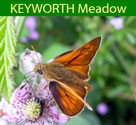
Keyworth Meadow LNR
Keyworth Wildflower Meadow
Kinoulton Marsh & Canal SSSI
Lily Ponds LWS
Meadow Covert Wood
Meadow Park
Millennium Green, Orston
New Wood, Bunny LWS
Normanton Pastures SSSI
Old Wood Nature Reserve
Orston Plaster Pits SSSI
Rancliffe Wood
Rushcliffe Country Park
Rushcliffe Golf Course
Sharphill Wood LNR & LWS
Sheldon Field
Skylarks Nature Reserve
Springdale Wood
Stanford Park LWS
Stanford-on-the-Wolds Golf Course LWS
Sutton Bonington Meadow & Spinney LNR
The Hook
Upper Saxondale
Widmerpool Notified Road Verge
Wilford Clay Pits Nature Reserve
Wilford Hill Wood
Willoughby Wood
Willwell Farm Cutting Nature Reserve
Great Central Railway
Green Line SINC
Gresham Marsh
Hickling Notified Road Verge
Holme Pierrepont
Keyworth Meadow LNR
Keyworth Wildflower Meadow
Kinoulton Marsh & Canal SSSI
Lily Ponds LWS
Meadow Covert Wood
Meadow Park
Millennium Green, Orston
New Wood, Bunny LWS
Normanton Pastures SSSI
Old Wood Nature Reserve
Orston Plaster Pits SSSI
Rancliffe Wood
Rushcliffe Country Park
Rushcliffe Golf Course
Sharphill Wood LNR & LWS
Sheldon Field
Skylarks Nature Reserve
Springdale Wood
Stanford Park LWS
Stanford-on-the-Wolds Golf Course LWS
Sutton Bonington Meadow & Spinney LNR
The Hook
Upper Saxondale
Widmerpool Notified Road Verge
Wilford Clay Pits Nature Reserve
Wilford Hill Wood
Willoughby Wood
Willwell Farm Cutting Nature Reserve
All the designated sites in Rushcliffe and south Notts
Below is a list of all the Local Wildlife Sites, Ancient Woodlands, Local Nature Reserves and Sites of Special Scientific Interest.
Local Wildlife Sites
| Parish | Title of LWS | Area (Ha) | NGR 1 (SK) | NGR 2 (SK) | NGR 3 (SK) | NGR 4 (SK) |
|---|---|---|---|---|---|---|
| Barton in Fabis | Brandshill Wood | 14.4 | 530334 | |||
| Barton in Fabis | Brandshill Grassland | 12.1 | 534337 | |||
| Barton in Fabis | Barton Flash | 8.8 | 527341 | |||
| Barton in Fabis / Nottingham | Brandshill Marsh | 3.9 | 532339 | |||
| Barton in Fabis | Fishing Pools | 1.7 | 518327 | 518323 | ||
| Barton in Fabis | Borrow Pits, | 1.1 | 527332 | |||
| Barton in Fabis | Pond and Drain | 0.45 | 528339 | |||
| Bingham / Wiverton Hall / Whatton / Granby | Bingham Linear Park | 11.7 | 696396 | 732368 | ||
| Bradmore | Rancliffe Wood | 20 | 597307 | |||
| Bunny | Old Wood | 32.5 | 588284 | |||
| Bunny | New Wood | 13.9 | 573284 | |||
| Bunny | Windmill Hill Wood (Bluebell Wood) | 8 | 598289 | |||
| Bunny | Rough Hill | 5.7 | 568286 | |||
| Bunny | Lodge Plantation Pond | 2.9 | 594297 | |||
| Bunny | Marblaegis Mine | 2.8 | 585288 | |||
| Bunny | Bunny Park Ponds | 2.6 | 596296 | |||
| Bunny | Bunny Park Road | 2.2 | 590291 | |||
| Bunny | Rough Grassy Scrub | 0.7 | 572287 | |||
| Bunny | Fairham Brook | 0.5 | 573293 | |||
| Car Colston | High Westings Farm Marsh | 1.6 | 707418 | |||
| Clipston on the Wolds | Wolds Plantation | 0.8 | 633325 | |||
| Clipston on the Wolds | Wolds Lane Verges | 0.4 | 638335 | |||
| Clipston on the Wolds / Cotgrave | Cotgrave Forest | 150.5 | 646330 | |||
| Colston Bassett | Stroomfields Verges | 0.2 | 712340 | |||
| Colston Bassett | Kaye Wood Pond | 0.02 | 702323 | |||
| Colston Bassett / Langar cum Barnstone | Hose Lane Verges | 2.5 | 714315 | |||
| Colston Bassett / Wiverton Hall /Bingham / Whatton / Aslockton / Elton / Orston / Thoroton / Shelton / Flawborough | River Smite | 6.7 | 725378 | |||
| Costock | Intake Wood | 5.9 | 588275 | |||
| Costock | Ash Lane Meadows | 4.1 | 570279 | 573279 | ||
| Costock | Costock Meadow | 1.8 | 573282 | |||
| Costock | Costock Grassland | 0.3 | 577278 | |||
| Costock / Rempstone | Sheepwash Brook Wetlands | 4.9 | 566250 | |||
| Cotgrave | Cotgrave Colliery (Country Park) | 42.4 | 647365 | |||
| Cotgrave / Cropwell Bishop / Colston Basset /Kinoulton / Hickling | Grantham Canal (Hollygate Bridge to Kinoulton) | 15.1 | 680339 | |||
| Cotgrave / Tollerton / Holme Pierrepont / Gamston / West Bridgford | Grantham Canal (Cotgrave to River Trent) | 7.1 | 584384 | 620371 | ||
| Cropwell Bishop | Gypsum Spoil | 5.6 | 681348 | |||
| Cropwell Bishop | Hoe Hill Pasture | 2.5 | 679359 | |||
| Cropwell Bishop | Gypsum Quarry | 2.2 | 674354 | |||
| Cropwell Bishop | Cropwell Bishop Gypsum Spoil II | 1.5 | 671355 | |||
| Cropwell Bishop | Cropwell Bishop Relict Pasture | 0.7 | 673353 | |||
| Cropwell Bishop | Colston Road Farm Grassland | 0.6 | 681341 | |||
| Cropwell Butler | Berry Hill Pond | 0.2 | 675367 | |||
| Cropwell Butler | Cropwell Butler Pond | 0.15 | 686371 | |||
| Cropwell Butler | Cropwell Butler Pond | 0.15 | 686370 | |||
| East Bridgford | East Bridgford Pasture | 2.7 | 701454 | |||
| East Bridgford | Pasture Bank | 1 | 696449 | |||
| East Bridgford | Trent Hills | 0.5 | 697451 | |||
| East Bridgford | Trent Hills Pool | 0.15 | 700455 | |||
| East Bridgford / Kneeton / Flintham | River Trent (Gunthorpe to Fiskerton) | 72.4 | 713459 | |||
| East Bridgford. | Trent Hills Wood | 8.1 | 696449 | |||
| East Leake | Hotchley Hill | 7.4 | 558285 | |||
| East Leake | East Leake Bridleway Verges | 2 | 561283 | |||
| East Leake | Manor Farm Grassland, East Leake | 1.5 | 599254 | |||
| Elton | Oldfield Plantation | 4.8 | 771393 | |||
| Elton | Railway Pond, Orston | 0.5 | 760400 | |||
| Flawborough | Kilvington Lakes | 82.9 | 795437 | 793431 | 790432 | |
| Flawborough | Flawborough Ponds (The Triangle) | 1.8 | 787426 | |||
| Flintham | Flintham Park | 97.4 | 735461 | |||
| Flintham | Flintham Wood | 19.1 | 726485 | |||
| Flintham | Barleyhole Wood | 6.7 | 739447 | |||
| Flintham | Stoneydale Plantation | 3.6 | 721446 | |||
| Gamston / Holme Pierrepont | Gamston Pits (A52 Lake) | 106.6 | 614381 | |||
| Gotham | Rushcliffe District Golf Course | 26.6 | 543281 | |||
| Gotham | Gotham Hill Pasture | 8.5 | 531309 | |||
| Gotham | Gotham Wood | 7.7 | 523293 | |||
| Gotham | Long Spinney Pastures | 4.5 | 534311 | |||
| Gotham | Court Hill Grassland | 2.8 | 539286 | |||
| Gotham | Hill Road Grassland | 2 | 534293 | |||
| Gotham | Gotham Disused Railway | 1.8 | 535296 | |||
| Gotham | Cuckoo Bush | 0.5 | 534292 | |||
| Gotham / Barton in Fabis | Long Spinney | 14.7 | 533312 | |||
| Granby | Granby Green Lane Grasslands | 3.4 | 759357 | |||
| Granby | Granby Green Lane | 1.7 | 760358 | |||
| Granby | Sutton Pond | 0.03 | 770375 | |||
| Granby | Granby Lodge Pond | 0.01 | 760358 | |||
| Hawksworth / Flintham | Car Dyke | 0.6 | 755444 | |||
| Hickling | Broughton Wolds Grasslands | 11.1 | 659270 | |||
| Hickling | Hickling Standard Pasture | 9.7 | 682280 | |||
| Hickling | Crossroads Meadow | 7.5 | 655288 | |||
| Hickling | Hickling Green Lane Verges | 3.1 | 681276 | |||
| Hickling | Hickling Meadow South | 2.6 | 669270 | |||
| Hickling | Bridegate Lane Verge | 1.3 | 677285 | |||
| Hickling | Folly Hall Lane Meadow | 0.4 | 663265 | |||
| Hickling | Hickling Track and Bank | 0.15 | 665289 | |||
| Holme Pierrepont | Holme Pierrepont | 82.3 | 623399 | |||
| Holme Pierrepont | Shady Lane Pits (New Skylarks) | 54.2 | 624386 | |||
| Holme Pierrepont | Holme Pierrepont | 29.2 | 618388 | |||
| Holme Pierrepont | Holme Pierrepont (Finger Ponds) | 13.7 | 628395 | |||
| Holme Pierrepont | Skylarks NR | 10.8 | 620391 | |||
| Holme Pierrepont | Pinder's Pond | 2.5 | 599385 | |||
| Holme Pierrepont | Holme House Grassland | 2.3 | 632383 | |||
| Holme Pierrepont | Adbolton Marsh | 0.4 | 603385 | |||
| Keyworth | BGS Meadow | 4.4 | 623315 | |||
| Keyworth | Wolds Lane Meadow | 1.7 | 616298 | |||
| Keyworth | Fairham Brook Pasture | 1.4 | 612290 | |||
| Keyworth / Widmerpool | Roehoe Brook | 0.2 | 631290 | |||
| Keyworth / Wysall | Fairham Brook (inc Keyworth Meadow) | 3.6 | 612289 | |||
| Kingston on Soar | Copse, Kingston on Soar | 3 | 513291 | |||
| Kingston on Soar | Kinoulton Grassland II | 2 | 672307 | |||
| Kinoulton | Kinoulton Gorse | 7.5 | 659309 | |||
| Kinoulton | Kinoulton Meadow | 7.4 | 676301 | |||
| Kinoulton | Kinoulton Lane Pasture | 3 | 666304 | |||
| Kinoulton | Kinoulton Wolds Middle Pasture | 2.8 | 661305 | |||
| Kinoulton | Kinoulton Marsh | 2.3 | 678304 | |||
| Kinoulton | Kinoulton Grasslands | 1.6 | 673308 | |||
| Kinoulton | Kinoulton Wolds Lower Pasture | 1 | 663305 | |||
| Kinoulton | Kinoulton Wolds Upper Pasture | 1 | 660304 | |||
| Kinoulton | Kinoulton Grassland | 0.9 | 673306 | |||
| Kinoulton / Hickling | Grantham Canal (Kinoulton to River Smite) | 4.9 | 675306 | 714294 | ||
| Kneeton | College Woood Pasture | 6.3 | 714468 | |||
| Langar cum Barnstone | Langar Quarry | 23.9 | 732348 | |||
| Langar cum Barnstone | Langar Airfield | 20.3 | 734337 | 734334 | 741341 | 747333 |
| Langar cum Barnstone | Barnstone Dismantled Railway | 4.7 | 746348 | |||
| Langar cum Barnstone | Barnstone Disused Railway | 1.5 | 748344 | |||
| Langar cum Barnstone | Barnstone Grassland | 1.2 | 742353 | |||
| Langar cum Barnstone | Naturescape Pond | 0.04 | 733341 | |||
| Normanton on Soar | Pond and Quarry Spoil | 1.1 | 536240 | |||
| Normanton on the Wolds | Normanton Pastures | 16.5 | 625332 | |||
| Normanton on the Wolds | Normanton on the Wolds Cutting | 1.7 | 627321 | |||
| Nottingham | Beeston Weir River Deposits | 2.9 | 536351 | |||
| Nottingham | Trent Carr, Clifton | 3.2 | 538348 | |||
| Nottingham | Holme Pit | 6.5 | 535345 | |||
| Nottingham | Clifton Wood | 12.2 | 538345 | |||
| Nottingham | Burrows Farm Grassland | 1.7 | 535342 | |||
| Nottingham | Clifton Fox Covert | 2.8 | 539341 | |||
| Nottingham | Clifton Grove | 13.9 | 545353 | |||
| Nottingham | Clifton Spinney Pond | 1 | 556357 | |||
| Nottingham | Fairham Brook North of Fairham Bridge | 13.1 | 560356 | |||
| Nottingham | Fairham Brook Nature Reserve | 10.9 | 558335 | |||
| Orston | Orston Quarry and Grasslands (Plaster Pits) | 5.8 | 762401 | |||
| Orston | Orston Railway | 4.1 | 778399 | |||
| Orston | Orston Horse Pastures | 1.8 | 771413 | |||
| Owthorpe | Borders Wood | 60 | 659329 | |||
| Owthorpe | Fishpond Plantation | 2.5 | 677335 | |||
| Owthorpe | Herrywell Lane | 0.8 | 666328 | |||
| Plumtree | Plumtree Disused Railway | 4.2 | 607330 | |||
| Radcliffe on Trent | Dewberry Hill | 7.4 | 656390 | |||
| Radcliffe on Trent | The Avenue Pool (Lily Pond) | 1 | 649404 | |||
| Radcliffe on Trent / Shelford and Newton | Trent Bluff Scrub | 3.7 | 650406 | |||
| Ratcliffe on Soar | Red Hill | 5.3 | 493304 | |||
| Ruddington | Rushcliffe Country Park | 63.6 | 572320 | |||
| Ruddington | Wilwell Cutting | 7.8 | 566349 | |||
| Ruddington | Ruddington Railway | 6.5 | 565327 | |||
| Ruddington | Ruddington Moor Drain | 0.1 | 558318 | |||
| Ruddington / East Leake / Stanford on Soar | Great Central Railway (GCR) | 33.1 | 543257 | |||
| Saxondale | Saxondale Railway | 9.2 | 677401 | |||
| Shelford and Newton | Shelford Carr | 20.1 | 667434 | |||
| Shelford and Newton | Swallow Plantation | 2.3 | 654415 | |||
| Shelford and Newton | Shelford Manor Pond | 0.2 | 673433 | |||
| Shelford and Newton | Manor Lane Bank, Shelford | 0.15 | 664429 | |||
| Shelford and Newton | Field Lane Dyke | 0.1 | 667419 | |||
| Shelford and Newton | Manor Lane Bank | 0.1 | 664430 | |||
| Stanford on Soar | Stanford Park | 113.1 | 559237 | |||
| Stanford on Soar | Fox Hill Scrub | 5.4 | 536221 | |||
| Stanford on Soar | Old Soar, Stanford | 0.8 | 541220 | |||
| Stanford on Soar | R.Soar Oxbow Lake | 0.6 | 525219 | |||
| Stanford on Soar / Normanton on Soar / Sutton Bonington / Kingston on Soar / Ratcliffe on Soar | R. Soar Loughborough Meadows to Trent | 54.3 | 492258 | |||
| Stanton on the Wolds | Stanton on the Wolds Golf Course | 50.2 | 631309 | |||
| Stanton on the Wolds | Jerico Farm Grassland | 5.9 | 652308 | |||
| Stanton on the Wolds | Stanton on the Wolds Field Pond (III) | 0.08 | 651307 | |||
| Stanton on the Wolds | Jerico Farm Pond I | 0.07 | 650304 | |||
| Stanton on the Wolds | Stanton on the Wolds Field Pond I | 0.05 | 650307 | |||
| Stanton on the Wolds | Stanton on the Wolds Field Pond (II) | 0.04 | 650309 | |||
| Stanton on the Wolds | Jerico Farm Pond II | 0.03 | 650302 | |||
| Stanton on the Wolds | Roehoe Wood Pond | 0.01 | 652301 | |||
| Stanton on the Wolds / Widmerpool | Stanton Railway (including Stanton Tunnel) | 13.3 | 636311 | 645296 | ||
| Sutton Bonington | St Anne's Church | 0.3 | 507250 | |||
| Thorpe in the Glebe | Thorpe in the Glebe Plantation | 5.4 | 620260 | |||
| Thorpe in the Glebe | Woodside Farm Grassland | 4.1 | 615259 | |||
| Thorpe in the Glebe | Thorpe in the Glebe Meadow | 3.7 | 613260 | |||
| Thorpe in the Glebe | Plantation Grassland | 3.3 | 619260 | |||
| Thorpe in the Glebe | Woodside Farm Grassland 1 | 1.5 | 617259 | |||
| Thorpe in the Glebe | Woodside Farm Orchard | 0.7 | 615261 | |||
| Thorpe in the Glebe | Boundary Grassland | 0.5 | 608258 | |||
| Thorpe in the Glebe | Thorpe in the Glebe Pond | 0.03 | 606255 | |||
| Thrumpton | Thrumpton Park | 78.7 | 506311 | |||
| Thrumpton | Gotham Hill Woods | 34.8 | 522306 | |||
| Thrumpton | Thrumpton Bank | 0.4 | 513320 | |||
| Tithby | Fernhill Farm Grasslands | 9 | 701357 | |||
| Upper Broughton | Upper Broughton Pasture | 17.1 | 675253 | |||
| Upper Broughton | Upper Broughton Meadows | 10.3 | 671254 | |||
| Upper Broughton | Upper Broughton Meadow | 4.7 | 678253 | |||
| Upper Broughton | Railway, Upper Broughton | 3.1 | 671259 | |||
| Upper Broughton | Upper Broughton Meadow II | 2.3 | 680255 | |||
| Upper Broughton | Upper Broughton Pond | 0.04 | 668256 | |||
| Upper Broughton | Upper Broughton Pond (I) | 0.01 | 683265 | |||
| West Bridgford | Sharphill Wood | 9.6 | 585349 | |||
| West Bridgford | Trentside, West Bridgford | 6.8 | 571378 | |||
| West Bridgford | Iremonger Pond | 4.5 | 569379 | |||
| West Bridgford | West Bridgford Disused Railway (Green Line) | 4.4 | 586365 | |||
| West Bridgford | Trent Pasture (Gresham marsh) | 4.1 | 574373 | |||
| West Bridgford | Wilford Claypits | 3.9 | 570355 | |||
| West Bridgford | Wilford Hill | 3.6 | 577350 | |||
| West Bridgford | Wilford Disused Railway | 3.2 | 568373 | |||
| West Bridgford | Greythorne Dyke | 1.3 | 573365 | 573372 | ||
| West Bridgford | Compton Acres Ponds | 0.6 | 568362 | 570361 | ||
| West Leake | Crownend Wood (Eastern Assart) | 2.1 | 530282 | |||
| West Leake | Crownend Wood (Western Assart) | 1.8 | 529285 | |||
| West Leake | Ash Spinney Assart | 1.2 | 537273 | |||
| West Leake | Leake New Wood Track | 0.6 | 535281 | |||
| West Leake | Pithouse Lane Marsh | 0.6 | 525260 | |||
| West Leake | West Leake Hills | 0.4 | 533280 | |||
| West Leake | Crownend Wood Ride | 0.2 | 528286 | |||
| Widmerpool | Roehoe Wood | 15.2 | 645301 | |||
| Widmerpool | Widmerpool Hall Woods | 12.2 | 629285 | |||
| Widmerpool | The Stonepits | 4.9 | 631286 | |||
| Widmerpool | Roehoe Wood Grassland | 2.8 | 650298 | |||
| Widmerpool | Widmerpool Grange Pond | 1.8 | 633277 | |||
| Widmerpool | A606 Woodland | 1.2 | 650292 | |||
| Widmerpool | Staion Road Verge | 0.6 | 633289 | |||
| Widmerpool | Thurlby Lane Verge | 0.3 | 639293 | |||
| Widmerpool / Wysall | Fairham Brook, Widmerpool | 0.6 | 625277 | |||
| Willoughby on the Wolds | Willoughby on the Wolds Stream Grassland | 4.3 | 621262 | |||
| Willoughby on the Wolds | Willoughby on the Wolds Border Grassland | 2 | 626255 | |||
| Willoughby on the Wolds | Willoughby on the Wolds Drain | 1.4 | 646262 | |||
| Willoughby on the Wolds | Willoughby on the Wolds Pond North | 0.02 | 642257 | |||
| Willoughby on the Wolds | Broughton Lodge Pond | 0.02 | 649250 | |||
| Willoughby on the Wolds | Woodside Farm Pond | 0.02 | 616259 | |||
| Wysall | Wysall West Grassland | 3 | 603279 | |||
| Wysall / Thorpe in the Glebe | Costock Road (iii) | 1.3 | 599266 |
Ancient Woodlands
| Parish | Title | NGR (SK) | Designation |
|---|---|---|---|
| Gotham | New Kingston Woodland | 520289 | Ancient / Semi-natural Woodland |
| Gotham | Gotham Wood | 523292 | Ancient / Semi-natural Woodland |
| Shelford and Newton / Radcliffe on Trent | Malkin Hill Wood | 650404 | Ancient / Semi-natural Woodland |
| Bunny | Old Wood, Bunny | 589284 | Ancient / Semi-natural Woodland |
| Flintham | Flintham Wood | 726485 | Ancient / Semi-natural Woodland |
| Kneeton | College Wood | 715469 | Ancient / Semi-natural Woodland |
| Kneeton / East Bridgford | Ewan's Wood | 705460 | Ancient / Semi-natural Woodland |
| Kneeton | Shipman's Wood | 709463 | Ancient Replanted Woodland |
Local Nature Reserves
| Parish | Title | NGR (SK) |
|---|---|---|
| Sutton Bonington | Sutton Bonington Meadow & Copse | 501249 |
| Keyworth | Keyworth Meadow | 613289 |
| Ruddington | Rushcliffe Country Park | 574321 |
| Ruddington | Wilwell Cutting | 566349 |
| West Bridgford | Sharphill Wood | 586348 |
| Bingham / Wiverton Hall / Whatton / Granby | Bingham Linear Park | 696396 |
Sites of Special Scientific Interest
| Gotham | Gotham Hill Pastures | 531309 |
|---|---|---|
| Ruddington | Wilwell Cutting | 566349 |
| West Bridgford | Wilford Clay Pits | 570355 |
| Gotham | Rushcliffe Golf Course | 543281 |
| Normanton on the Wolds | Normanton Pastures | 625332 |
| Orston | Orston Plaster Pits | 762401 |
| Langar cum Barnstone | Barnstone Railway Cutting | 742353 |
| Kinoulton | Kinoulton Marsh and Canal | 678304 |
Site Designed and Created by Neil Pinder
This document was last modified on:
neil.pinder@ntlworld.com
Google uses COOKIES on this site. For information on how to control and delete cookies visit: AboutCookies.org